
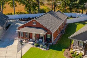
Aerial media is valuable when a higher viewpoint explains land, access, surroundings, amenities, or scale. It should answer a property question, not simply add a dramatic angle.
Use altitude to reveal relationships
Ground-level photography is best for rooms, finishes, details, and the experience of standing at the property. An aerial view can supply the larger map. It can show how a residence sits on its lot, where a detached building is located, how a driveway approaches the home, or how outdoor spaces relate to one another.
That context matters most when the relationships are part of the listing story. On an acreage property, one elevated frame may show the residence, open land, tree line, and outbuildings together. For an equine property, a carefully chosen viewpoint can help a viewer see how a home, barn, arena, fenced areas, and surrounding landscape are arranged. In a neighborhood, aerial media may clarify the property’s setting or proximity to a visible feature, provided the image does not imply rights or access that have not been established.
Use verified work as a guide, not a promise
PyP’s current aerial work includes overhead and elevated views of the Pentecost property. Those images demonstrate different jobs: one gives a direct sense of placement, while wider views connect the residence to surrounding land. Approved equestrian-property imagery used elsewhere in PyP’s current materials similarly shows why a high viewpoint can be useful when several buildings, fenced areas, and landscape features contribute to the story.
These examples illustrate how perspective can clarify a site. They do not mean the same shot, altitude, or flight path will be appropriate at every property.
Aerial imagery is visual context, not legal evidence
A photograph can show what was visible from the camera’s position on the day of the shoot. It cannot establish a surveyed boundary, a legal point of access, an easement, or ownership of a neighboring road, pond, trail, clubhouse, field, or other amenity. Apparent lines in a landscape, including fences, mowing patterns, tree lines, and driveways, may not match legal boundaries.
If a marketing plan calls for a boundary graphic or a label identifying an off-property feature, the agent should provide accurate source information and confirm that the finished presentation is appropriate for the listing. Aerial media should support verified facts, not substitute for a survey, title work, association documents, or professional advice.
Plan for conditions that can change the flight
Aerial coverage is situation-dependent. The Aerial Photo and Video service evaluates the specific property rather than promising drone coverage everywhere.
- Weather: Wind, precipitation, visibility, and rapidly changing conditions can make a planned flight impractical or unsafe.
- Airspace: Controlled airspace and temporary restrictions may require authorization or prevent the intended operation. FAA guidance requires authorization for drone flights in controlled airspace around airports, and pilots must still check current restrictions and conditions.
- Site conditions: Trees, utility lines, nearby people, traffic, animals, structures, and available launch space can limit a safe camera position or flight path.
- Operational judgment: The final decision depends on the conditions at the property and the requirements that apply at that time.
Those limits are part of responsible planning. If an aerial view cannot be captured safely or lawfully, a different ground-level composition may still communicate part of the setting, but it should not be presented as an equivalent view.
Pair context with the property experience
Aerial images rarely replace the rest of the media set. The most useful combination often begins with ground-level photography that explains the home itself, then adds selected aerial frames for the relationships that cannot be seen from the ground. Aerial motion can also become one part of a listing-video sequence, connecting an approach, the residence, and the broader setting.
Before ordering, identify the relationship a higher viewpoint needs to explain. Share any acreage, access, outbuilding, amenity, or site detail that matters to the campaign, while separating verified property facts from visual impressions.
Order listing media when the need is clear, or ask PyP a coverage question when airspace, location, or the desired perspective needs discussion.